
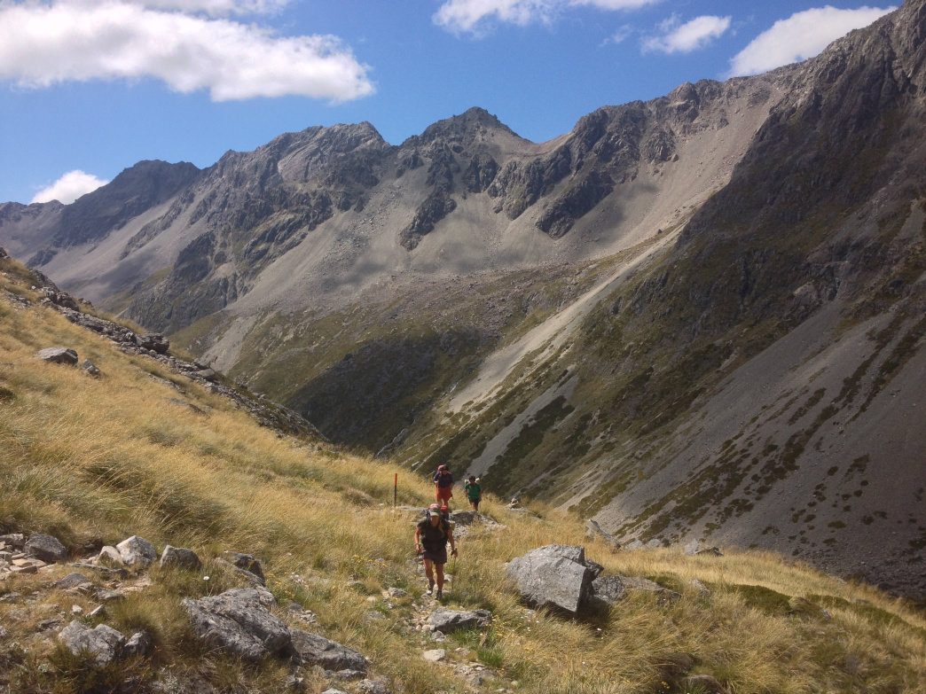
 Hiking on the way up to Travers Saddle in Nelson Lakes National Park.
 You can bet that one of the world’s newest long-distance trail systems, the Te Araroa in New Zealand, will shoot to the top of any thru hiker’s bucket list as soon as they learn about it. Beginning at Cape Regina on the northern tip of the North Island, the trail winds 1,900 miles south through farmland, cities, along oceans and up mountains to its termination point, Bluff, on the southern tip of the South Island. The patchwork trail consists of private land easements, public trails, highways, and dry riverbeds, allowing for an intimate experience with the land and the people of New Zealand.
Zach VanderPlate, an American long distance hiker, set his sights on the Te Araroa (TA for short) after learning about it from a fellow hiker while on the Pacific Crest Trail in 2013. Zach and his girlfriend Amy spent four and a half months hiking the Te Araroa in late 2015 into early 2016. Here Zach shares his experience and what he learned by tramping the length of the Land of the Long White Cloud.
How did your previous thru hikes like the PCT and the Baek-Dudaegan in Korea prepare you for the Te Araroa? Having hiked the Pacific Crest Trail and half of the Appalachian Trail, I had a handle on how to pack and what to expect physically and mentally. I think the most important thing to bring on a long hike is a positive attitude and an open mind. I like to take a moment when I first wake up to appreciate just how awesome life is. No matter what happens after that, I am ready to take it in stride.

Zach VanderPlate
What makes the Te Araroa unique as a trail system? The TA is incredibly diverse and balanced. As soon as we found ourselves growing tired of something, there was something completely different around the corner. Unlike the trails in the U.S., the TA is a network of trails linked by connector sections, including roads, and private property easements, mostly farmland. The Department of Conservation (DOC) often puts up orange markers and relies on the tread power of foot traffic to construct the track.
Often, above treeline or in fields on the TA, you have to scan the horizon for the tiny orange pole off in the distance, walk to it, and start straining your eyes for the next one. This becomes impossible in heavy rain or fog. Being able to read a topo map and thus knowing where you are supposed to be going is very useful. GPS is also a useful tool, but should not be relied upon solely.

Zach VanderPLate
Which part of the trail did you find the most inspiring or beautiful? The diversity of the TA is unbelievable. There are dense muddy forests—sometimes you sink in up to your knees. There are long road walks–some on the nation's busiest highway, some on country roads where you see (as few as) three cars. There are alpine traverses and long beach walks. The trail goes right through several of New Zealand’s largest cities and some of its most remote areas. Sometimes the trail is a dry riverbed, sometimes it follows a creek. In one section, you get in a boat and paddle the Whanganui River.
_What was the social life like on the tramp? _ We were surprised to not meet another thru-tramper for our first two weeks. It wasn't until the Puketi Forest that we happened upon other hikers. We ended up meeting quite a few people along the way. There is a definite trail culture somewhat similar to that of the U.S. trails, but on a much smaller scale. The trail is definitely in its early years, but it is growing fast.

Zach VanderPlate
Which part of the trail did you find the most inspiring or beautiful? The North Island is about the people. The South Island is about the mountains. On the North Island, walking across kilometers of working farms and along dirt roads sandwiched between private properties forced us to interact with locals. You are constantly meeting Kiwis, and I feel we got a very unique glimpse into New Zealand culture. Not only Kiwi culture, but Maori culture as well. The South Island was about natural beauty. More rugged. More wild. More remote.
What did you find as your must-have piece of gear for this particular trek? Hiking poles were a must. In addition to being life savers in the mud and on river crossings, (they) save your knees for many more thru hikes to come. My umbrella was a great sunburn and migraine mitigator. New Zealand sits smack dab under the hole in the ozone and has the highest rate of skin cancer in the world. Sunscreen is also very expensive down there.

Zach VanderPlate
What impressions do you have about New Zealand after traveling the length of the country? In some ways, New Zealand feels like a utopia. Most people are incredibly friendly in a sincere way. They are practical and pragmatic. Most people seem content with what they have and don't waste. The island is very environmentally conscious, partly because their economy thrives on ecotourism, and also because they live in a place with limited resources, somewhat isolated from the rest of the world. In a word, New Zealand is idyllic.
Originally written by RootsRated for Craghoppers.
Featured image provided by Zach VanderPlate