
 Hiking in the Mojave.
 Ah, the desert: the “land of little rain”, the house of haboob and flash flood, the thirsty wilderness, the barren void wandered by nomads, exiles, spiritual seekers, bandits, prospectors, and UFO hunters—plus sidewinders, scorpions, tarantulas, and vultures, of course.
Taken collectively, the deserts of North America are still overshadowed sizewise by the Sahara—at 3.6 million square miles, the greatest (non-polar) desert in the world—as well as the Arabian, the Australian Outback, and several others. But in beauty, wilderness, and ecological uniqueness they hold their own with any desertscape on Earth.
We’re going to take a dusty, sandy, squinty-eyed look at the “Big Four” of North American deserts: the Great Basin, Mojave, Sonoran, and Chihuahuan, which together cover some 500,000 square miles—from the lonesome sagebrush backlands of Oregon and Nevada, down to the cactus groves of central Mexico.
Desert Definitions

Justin Meissen
There are various ecological and climatological definitions of “desert,” a rough-and-ready one being somewhere that gets 10 inches or less of annual precipitation. A more precise one calls a desert a place where evapotranspiration (evaporation plus the water given off by plants) exceeds precipitation.
Lots of places that don’t meet the technical criteria get slapped with the desert label nonetheless; heck, a big chunk of the Great Plains, mainly the mixed-grass and shortgrass prairies, was once called the “Great American Desert,” though these grasslands are too well-watered to formally qualify. We should acknowledge that “desert” can be a subjective term more to do with mood—solitude, awe, fear, terror—than rain gauges.
We don’t have the space to go into the nitty-gritty of why North America’s deserts sprawl where they sprawl, but suffice it to say it mainly has to do with rain shadow-casting mountains, distances from moisture sources, the permanent high-pressure zones of the subtropics, and combinations thereof.
(Oh, and before we dive in: The Arctic and Antarctic are polar deserts, getting as little yearly precipitation as many sand-and-cactus ones at lower latitudes. But we aren’t going to be considering the dry tundra of Alaska, Canada, or Greenland in this discussion: We’ll stick to the temperate and subtropical zones of North America.)
The Great Basin Desert

Bob Wick / BLM
Encompassing the better part of 200,000 square miles, the Great Basin Desert is the largest desert in the United States and the second-largest in North America after the Chihuahuan. This ecological realm covers most, but not all, of the physiographic realm of the Great Basin itself, the biggest component of the Basin-and-Range Province.
The Great Basin Desert stretches between the Southern Cascades and Sierra Nevada (source of the rain shadow that forms it) on the west and the Rocky Mountains on the east. To the north, it grades into the semiarid sagebrush and bunchgrass steppes of the Columbia Plateau and Snake River Plain; to the south, it drops down into the lower, hotter Mojave Desert. It takes up most of Nevada, while its fringes lie in northeastern California, southeastern Oregon, southwestern Idaho, and western Utah.
The Great Basin Desert is a cold desert: both a descriptive and formal term. It’s the northernmost major desert province in North America (again, non-polar) and gets most of its scanty annual precipitation in the form of winter snowfall.
Mountain range, basin, mountain range, basin: rinse and repeat. That’s the basic topographic story of the Great Basin Desert. Relief often on the order of 5,000 or 6,000 feet separates high mountain crests from the bottoms of the intervening sinks, or bolsons, which typically lack drainage outlets. Ephemeral lake beds (playas) lie on the floor of many of these basins, and of course there are few permanent water bodies here, too, like the Great Salt Lake and Pyramid Lake—remnants of larger and more numerous Great Basin lakes of the Pleistocene.

Mitch Gritts
If you’re into botanical variety, the Great Basin Desert gives you the least of the Big Four deserts. Sagebrush, especially big sagebrush, dominates the scene: They don’t call this heartland of the American West the ‘Sagebrush Sea’ for nothing. Greasewoods, saltbushes, saltgrasses, and other salt-tolerant plants take over on saline flats, scrawny gallery forests of cottonwood and willow line some streamways, a blackbrush realm helps segue the Great Basin Desert into the Mojave, and of course non-desert woodlands and straight-up forests grow in the mountains, but generally speaking this is a blue-gray sagebrush kingdom. But to some folks (count me in that number), an unpeopled Sagebrush Sea islanded with mountains has a siren’s call.
Vast public lands, mostly BLM-managed, serve as adventure gateways to the Great Basin Desert, which includes its share of iconic destinations: Nevada’s Black Rock Desert (Burning Man H.Q.) and the Bonneville Salt Flats among them. Much of Great Basin National Park lies in the wetter heights of the Snake Range, but its lower elevations show off fine desert wilds.
The wide-open spaces of the Great Basin Desert also host some impressive long-distance animal movements: Hart Mountain National Antelope Refuge in southeastern Oregon and Sheldon National Antelope Refuge in northwestern Nevada bookend a major pronghorn migration route that’s centered around winter range at Beatys Butte.
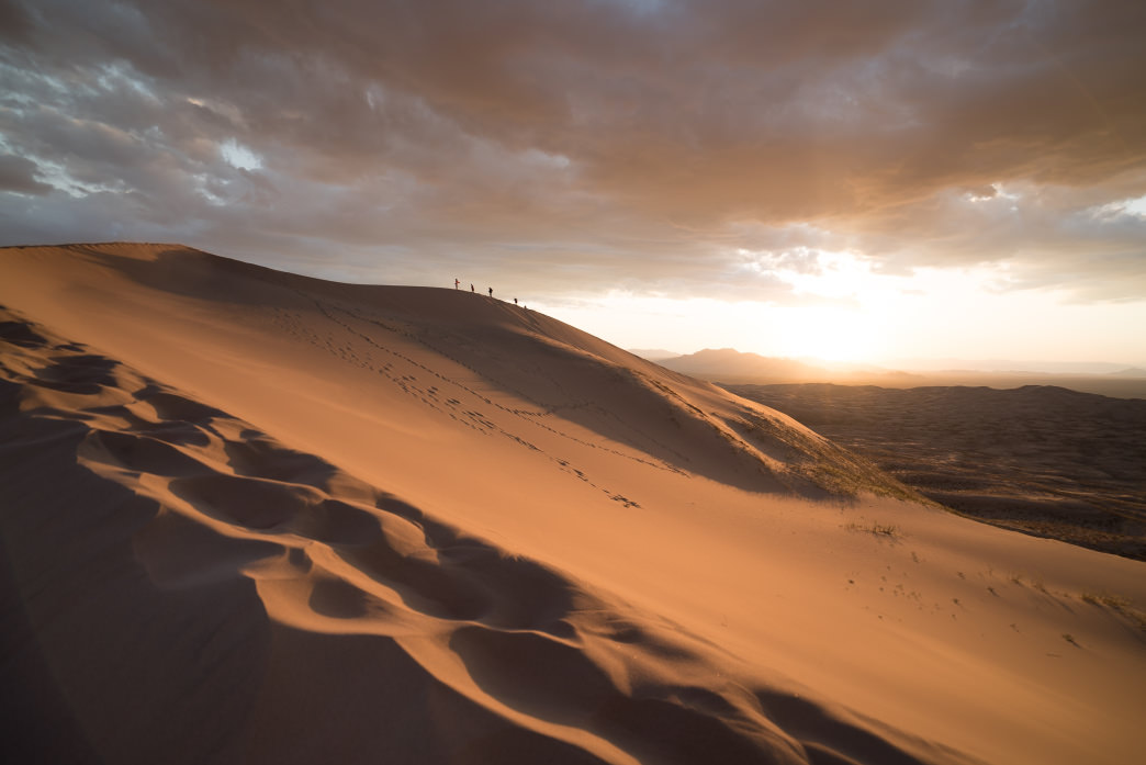
The Mojave Desert

Graeme Maclean
The Mojave Desert is the northernmost “hot desert” in North America and essentially a transition land between the Great Basin and Sonoran. It’s the smallest of the Big Four, covering some 54,000 square miles of southeastern California, southern Nevada, and itty-bitty strips of southwestern Utah and northwestern Arizona.
Like the Great Basin Desert, the Mojave gets most of its precipitation in winter; unlike it, most of that falls as rain. Springtime blooms of ephemeral Mojave wildflowers are awesome; sometimes they’re superblooms and all the awesomer.
Roughly speaking, the Great Basin Desert yields to the Mojave at the northern range limit of creosote bush, the defining shrub of North America’s hot deserts; its distribution essentially outlines them. You can rightly think of it as the hot-desert equivalent of big sagebrush.
But the trademark plant of the Mojave, the one whose geography basically maps out this desert, is the Joshua-tree. This outsized yucca actually flourishes best on the Mojave margins, reaching peak development on middle slopes of foothills and bajadas (the characteristic rubble-aprons edging desert mountain ranges).

Justin Meissen
Good places to wander among wacky and wonderful Joshua-tree forests are California’s Joshua Tree National Park (straddling the Mojave and Sonoran/Colorado deserts) and Mojave National Preserve. A stone’s throw or two from Zion National Park on the margin of the Colorado Plateau, meanwhile, you can check out some of the northernmost Joshua-trees—and the northeastern frontier of the Mojave Desert—a few miles south of St. George, Utah in the Woodbury Desert Study Area (also a popular rock-climbing spot).
The pinnacle of the Mojave Desert is Death Valley, although “pinnacle” is a dumb word to use for North America’s lowest piece of terra firma (282 feet below sea level in Badwater Basin). As we’ll get into, the Sonoran is, on average, the hottest and driest North American desert, but the 156-mile-long trench of Death Valley stands apart: Its summer mercury readings are among the most extreme on the planet, and by some counts it boasts the hottest-ever recorded air temperature, 134 degrees Fahrenheit on July 10, 1913.
Besides its fearsome weather, Death Valley dazzles with bizarre, beautiful, and forbidding landscapes: from the Zabriskee Point badlands to the corrugated saltpan of the Devil’s Golf Course. Death Valley also encompasses one of the most impressive elevational gradients on the continent: That basement of the continent, Badwater Basin, is only 15 miles from the summit of Telescope Peak in the Panamints, more than 11,000 feet above sea level.
The Sonoran Desert

Robb Hannawacker
The roughly 100,000-square-mile Sonoran ranks among the superlative deserts of the world: not for its size, but for its botanical and scenic splendor. The Sonoran Desert’s comparatively “lush” plantlife stems partly from the two rainy seasons that prevail in its eastern and southern sectors, which get both summer and winter precipitation.
More than two-thirds of the Sonoran Desert lies south of the U.S.-Mexico line, encompassing most of Baja California and a big chunk of the state of Sonora. In the U.S., the Sonoran Desert mostly occupies southern Arizona, with a small extent, the Colorado Desert, in southeastern California.
The epitomizing sight of the Sonoran Desert is the saguaro: that long-lived, skyscraping cactus that forms the stately desert woodlands starring in most people’s go-to mental image of Arizona—or, really, the American desert as a whole. The Sonoran is sometimes called an “arboreal desert” on account of those tree-sized cacti, mostly found east of the Colorado River; they’re prominent in the Arizona Upland, one of two Sonoran Desert divisions in the United States. Saguaro National Park, it goes without saying, is a standout destination for appreciating these kingsize celebrities among cacti.
The saguaro may be the best-known in the U.S., but the Sonoran Desert is an all-out cactus funland: There’s a crazy variety of species, shapes, and sizes, including, in the Mexican portion, the mighty cardon, an even bigger (but rangier) cousin of the saguaro. Then there’s the wild-armed ocotillo (or coachwhip), the fuzzy-but-stabby teddybear cholla, the chunky fishhook barrel cactus, and the multi-pillared organ pipe cactus that barely edges north of the border (where it plays a starring role in Organ Pipe Cactus National Monument).

Robb Hannawacker
And the rich floral quilt of the Sonoran isn’t confined to cacti, either: There’s also the creosote bush, the white bursage, the blue palo verde, the elephant tree, and the big California fan palm, which bristles in select washes and gulches in southeastern California and northern Baja, plus Palm Canyon in southwestern Arizona’s Kofa Mountains. Anza-Borrego Desert State Park, famous for its wildflower blossom blowouts, is also a great place to hike palm oases—and scout for desert bighorns, too.
Mostly sitting below 2,000 feet and positioned well south, the Sonoran is hotter and drier overall than the other North American deserts. The infernal core of the continent’s drylands—Death Valley notwithstanding—lies in the Sonoran Desert’s lowest and harshest reach, the Lower Colorado Valley (the other section along with the Arizona Upland that reaches the U.S.). It’s the region swaddling the head of the Gulf of California, and it includes California’s Salton Trough, the Colorado River Delta, and the vast, desolate Pinacate of northwestern Sonora, about which Edward Abbey had this to say (approvingly, of course):
This region is the bleakest, flattest, hottest, grittiest, grimmest, dreariest, ugliest, most useless, most senseless desert of them all. It is the villain among badlands, most wasted of wastelands, most foreboding of forbidden realms. At least in the Southwest, the Pinacate desert is the final test of desert rathood; it is here that we learn who is a true rat and who is essentially only a desert mouse.
Along with the hardscrabble volcanic outback of the Pinacate Shield, this Sonoran outback harbors the Gran Desierto de Altar, basically North America’s Sahara: Here you’ll find the continent’s biggest dunefield, built up from sediments deposited upwind in the Colorado River Delta, and its only active sand sea, or erg. The Algodones Dunes in California’s Yuma Desert are basically a northern extension of the Gran Desierto de Altar erg.
Southern Arizona’s sprawling Cabeza Prieta National Wildlife Refuge (one of Abbey’s favorite haunts) borders the Pinacate country and mirrors its remoteness.
The Chihuahuan Desert

Adam Baker
The Chihuahuan is the biggest desert in North America, slightly edging out the Great Basin, and also the easternmost and southernmost (it extends a little bit farther south than the Sonoran’s Baja quarter). More than 90 percent of its 200,000-plus square miles lie in Mexico, where the Chihuahuan rolls between the Sierra Madre Occidental and Sierra Madre Oriental.
North of the border, the Chihuahuan comprises a series of north-south lobes in southern New Mexico and, depending on whom you talk to, spills into a little bit of southeastern Arizona. A subtle but important gap occurs between the easternmost Sonoran Desert and the westernmost Chihuahuan in the U.S.—an expanse of high semiarid grasslands along one of the subtlest stretches of the Continental Divide. (The separation continues south into Mexico, so the Chihuahuan is the standalone desert among the Big Four: The Great Basin, Mojave, and Sonoran are contiguous.)
The Chihuahuan Desert is, like the Great Basin, a true high desert, much of it above 3,500 feet. Though it’s far southern stretch hosts tall cactus, the cacti roster here isn’t as significant as the Sonoran’s. Creosote bush and tarbush prevail over big stretches of the Chihuahuan, but the emblematic plants are agaves and yuccas; ocotillo and honey mesquite are also widespread.

Miguel Vieira
The scenic centerpiece of the U.S. portion of the Chihuahuan is West Texas’s Big Bend National Park, named for the canyon-chuted swerve taken by the Rio Grande along this length of the U.S.-Mexico boundary. This remote Chihuahuan wilderness showcases plants and animals rarely seen north of the border and offers a whole lot of spectacular backcountry to explore, from the three great canyons along the Big Bend to the high country of the Chisos Mountains.
The greatest pile of gypsum dunes, meanwhile, lies in the U.S. portion of the Chihuahuan Desert: the famous White Sands of New Mexico’s Tularosa Basin.
Concluding Farewell

Paxson Woelber
But what does it all mean? Should you know each and every geographic, botanical, and whatnot name about North American deserts? Or the ecology and biogeography of where exactly the Mojave bumps up against the Sonoran, or what the sagebrush steppe is versus desert shrubland? No, not necessarily.
The important thing is to get out there, out in the barren backlands, and explore them for yourself; to develop a better understanding of their terrifying beauty; to study how sand grains whip over the spine of a dune; the way stony mountains look under full moonlight; the way an old twisty sagebrush creaks in a cold desert wind. Tread lightly, taste just a little of the healthy and blood-deep fear the high white afternoon sun inspires on a summer afternoon, rekindle your gratitude for water, and shake out your boots in the morning in case it’s the one time out of 50 some glossy arachnid has taken up residence inside.
Embrace your inner desert rat, in other words.
Originally written by RootsRated.
Featured image provided by Joshua Sortino