
 Ocean views from the slopes of Mount Pelée
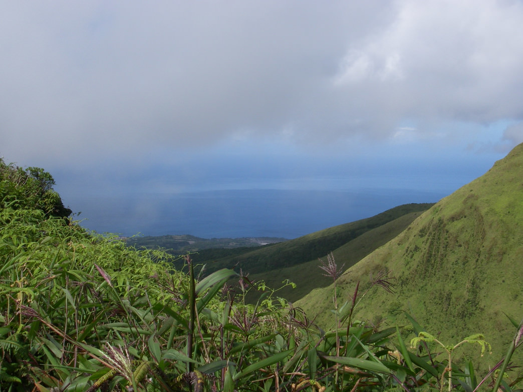
A trip to Martinique wouldn’t be complete without a trek up Mount Pelée. Hikers navigate circuitous but well-maintained jungle roads into a verdant paradise. Release any stress not already forgotten in the Caribbean waters as you plunge into crystalline rivières that tumble from Martinique’s highest peaks. Traverse exposed ridgelines into the surreal caldera of the island’s only active volcano.
At 4,583 feet, Mount Pelée towers over fishing villages, townships nestled in the landscape’s folds, and Saint-Pierre, the island’s former capital. Perilously placed in the volcano’s foothills, Saint-Pierre was formerly known as "the Paris of the Caribbean," a nod to the town’s bygone grandeur. On May 8, 1902, Mont Pelée erupted, decimating the town and 30,000 inhabitants with a swift pyroclastic flow containing superheated gasses, lava, and hot volcanic debris.
Among the rubble was Louis-Auguste Cyparis, a belligerent man constantly involved in bar brawls. The night before the eruption, police locked Cyparis in solitary confinement and unknowingly saved his life. The thick cell resisted fire, debris, and scorching volcanic gasses, barely shielding Cyparis from death. Of those who remained in Saint-Pierre, he was the sole survivor. His first-hand account attracted the attention of Barnum & Bailey Circus and Cyparis spent the rest of his days touring as "the man who lived through Doomsday."

ANDRE ALLAGUY-SALACHY
The fishing village’s 1902 ruins are well preserved and visitors learn about Cyparis and the eruption on a self-guided walking tour. Cyparis’s cell still stands, a stout building protected by formidable walls. In the same area are shops that feature produce and locally made gifts. If you’re lucky, shopkeepers will share personal stories of the eruption passed down through generations. Today, only 5,000 people populate Saint-Pierre.
Another eruption shouldn’t impede your hike, thanks to geophysicists and volcanologists who monitor the volcano’s seismic activity. Besides the satisfaction of climbing the Pompeii of the Caribbean, explorers can enjoy challenging boulder scrambles, a fern forest in the caldera, and breath-taking vistas of land and sea. Lush tropical forest covers the volcano’s base, featuring unique plants such as red ginger and orchids.
The steep, rocky trails are perfect for adventurers seeking a physical challenge. Don’t forget trekking poles. Check the forecast the morning of your hike, and be prepared for a sporadic Caribbean shower. Begin as early as possible, as clouds descend on all four main trails in the afternoon.

Antoine Hubert
The Grand-Rivière *and *Macouba routes begin in northern fishing towns untouched by the passage of time. These are the longest and most isolated routes, at 4.7 and 5 miles one way, respectively. They follow trails used by banana and sugarcane plantations before converging under a man-made mahogany forest. The trail becomes steeper before reaching an open savannah. As you ascend Morne Macouba, a 4,100’ peak with stunning northern views, the trail narrows to an exposed ridge formed by the outer edge of the caldera. Follow the ridge until you reach the trail’s terminus at a shelter.
The popular Ajoupa Bouillion hike begins north of Morne-Rouge. A volcano museum in this town showcases artifacts and models of volcanic events and is well worth a post-hike visit. The 7-mile round trip trail begins on the Aileron, a protrusion on Pelée’s eastern flank. Clouds often shroud the mountain’s windward side, so this trail yields the best views in the morning. Ascend stairs and fallen rock to switchbacks that lead to the crater rim. The exposed hike features top-of-the-world panoramic views.
Follow a sign in the direction of Le Chinois (the "Chinese man") and the cones named 1902 and 1929 to descend into the caldera. Thick fern forests, reminiscent of Jurassic Park, thrive in this moist, sheltered environment. Sunlight rarely reaches these slick rocks, making for a slow, treacherous climb. Take your time as you ascend to the 4,476-foot cone of 1902, which boasts outstanding northern views.
To reach Pelée’s highest peak, continue along the outer rim, turn left, and practice your bouldering technique as you climb jumbled rocks leading to Le Chinois. The 45-minute ascent is where you’ll be happy to have trekking poles. Pelée’s true summit features spectacular views of Saint-Pierre, the northern tip of Martinique, and the nearby island of Dominica.
Less frequented than Ajoupa Bouillion, the Grande-Savane hike is a beeline to the top. Just south of the village of Le Pêcheur, a rutted, one-track road winds through family homesteads. It climbs 2,000 feet and dead ends at the trailhead. The trail meanders through Caribbean jungle before gaining 1,500 feet over a 1.5-mile climb. Situated on the volcano’s leeward side, the hike is drier and clouds don’t accumulate as early in the day as on other sections. True to its name, the Grande-Savane route cuts through a vast savanna. It rises swiftly, intersects the caldera loop, and follows the same steep boulder scramble to Le Chinois.
Decades after volcanic rumblings destroyed Saint-Pierre, Mount Pelée beckons adventurers to her summit. On a cloudless day, a hike up this iconic volcano is sublime. Lush forests open into vast grasslands that narrow to steep, rocky ridges. From dreamlike vantage points high in the clouds, sailboats and yachts seem a world away. Panoramic views and quick elevation gains make the unforgettable Mount Pelée hike feel like a stairway to heaven.
Originally written by RootsRated for Atout France.
Originally written by RootsRated for Atout France.
Featured image provided by Jean & Nathalie