
Intro
The northeast corner of Yellowstone harbors some of the most beautiful and well-loved landscape of the park. You’ll travel up Pelican Creek, home to grizzly bears and wolves and down to the famed Lamar River with its broad glacial valley and world class fishing.
What Makes It Great
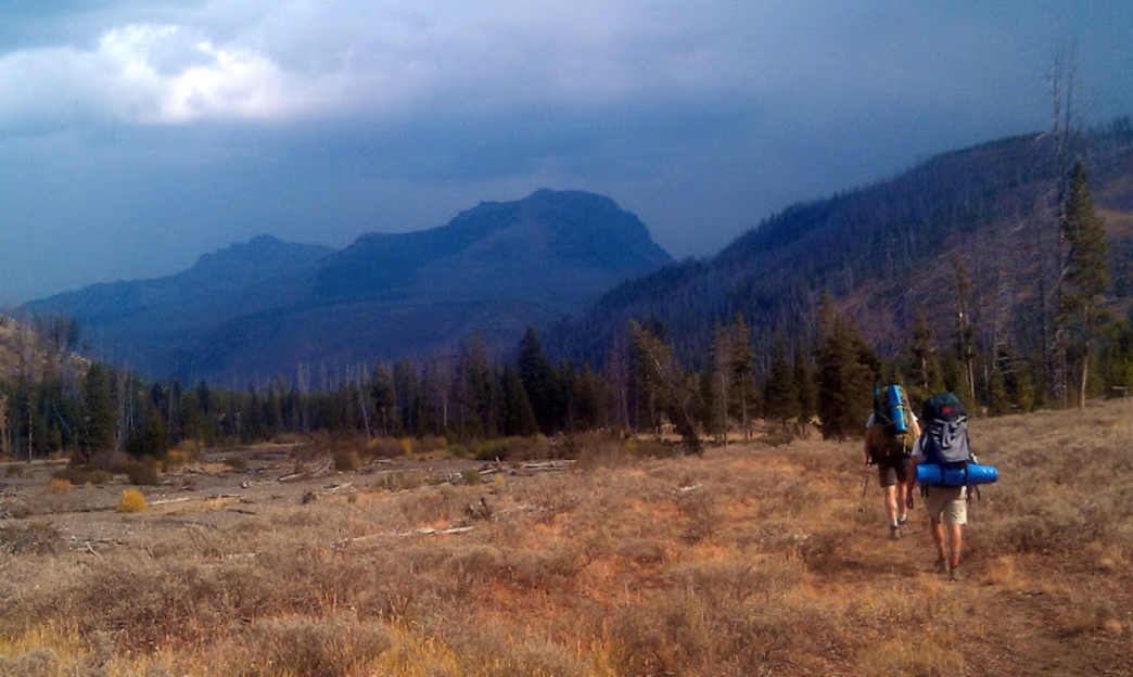
Unless you’re someone who loves the views from a mountain top, the scenery doesn’t get any better than what you’ll experience on this multi day experience. You’ll get it all – luscious wildflower meadows, open sagebrush, racing river, forested slopes, babbling brooks and distant, snow-covered peaks. Plus throw in the very distinct possibility of seeing Yellowstone’s iconic wildlife including elk, deer, moose, bison, grizzly bears and wolves to make this hike the perfect Yellowstone experience.
This is a 3 day, 33 mile moderate backpacking trip into a seldom visited section of the park. You’ll find day hikers at both ends and well as a troop of fishermen once you get closer to the Soda Butte Creek Trailhead. But the middle portion is quiet and lovely.
Start your trip at the Pelican Creek Trailhead after July 4th. Pelican Valley is closed to travel before that so the grizzlies get some alone time to fatten up after hibernation. Also note that travel is restricted to the hours of 9 am – 7 pm, for the same reason. Your first day’s travel will be 11.6 miles as you wander up slow-moving, windy Pelican Creek. At 7 miles you’ll reach the Pelican Springs Patrol Cabin. Enjoy a bite to each here before hoofing it over Mist Pass. As you come down from the pass, you’ll find the first campsites.
Day 2 is another moderate day at 10.3 miles with a couple of creek crossings to up the excitement scale. As you head toward the Lamar River you’ll catch glimpses of the peaks of the Absaroka Range. After about 6 miles you’ll make an easy crossing of the Lamar River and find your next campsite. The topography of Lamar Valley is rolling, sagebrush and grass covered hills that are stunning in their simplicity.
Day 3 is more up and downs along the river with three creek crossings. Eventually you’ll get views of the incomparable Lamar Valley. At this point foot and horse traffic will pick up as you finish up your 10.4 mile day at the Soda Butte Trailhead. Herds of bison might block your path as you tromp along.
Who is Going to Love It
There’s nothing not to love about this hike, unless you fall face first in fresh bison dung along the way. This is one hike that you don’t have to do gut-busting elevation gains to be treated to spectacular views. You can take it slow and indulge in some fishing, wildflower identification or general lounging in the sun to make the mileage more enjoyable. This trail is a great way to see Yellowstone at its finest.
Directions, Parking, & Regulations
From Cody, take US HWY 14/16/20 west into Yellowstone. You’ll find the Pelican Creek Trailhead just north (right) of Indian Pond and the Storm Point Nature Trail. There is a small dirt road into the parking area, which you can’t see from the road. If you get to the bridge over Pelican Creek you’ve gone too far. The parking area is substantial.
You’ll have to pay $25 for your entrance fee into the park and you’ll also need a backcountry use permit. Pets are not permitted in the backcountry at all. Cell service will probably be non-existent. Carry bear spray.
Featured image provided by Leslie Tribble